Juggling with three landscapes makes my mind spin

Heavily polluted runoff from an abandoned tin mine

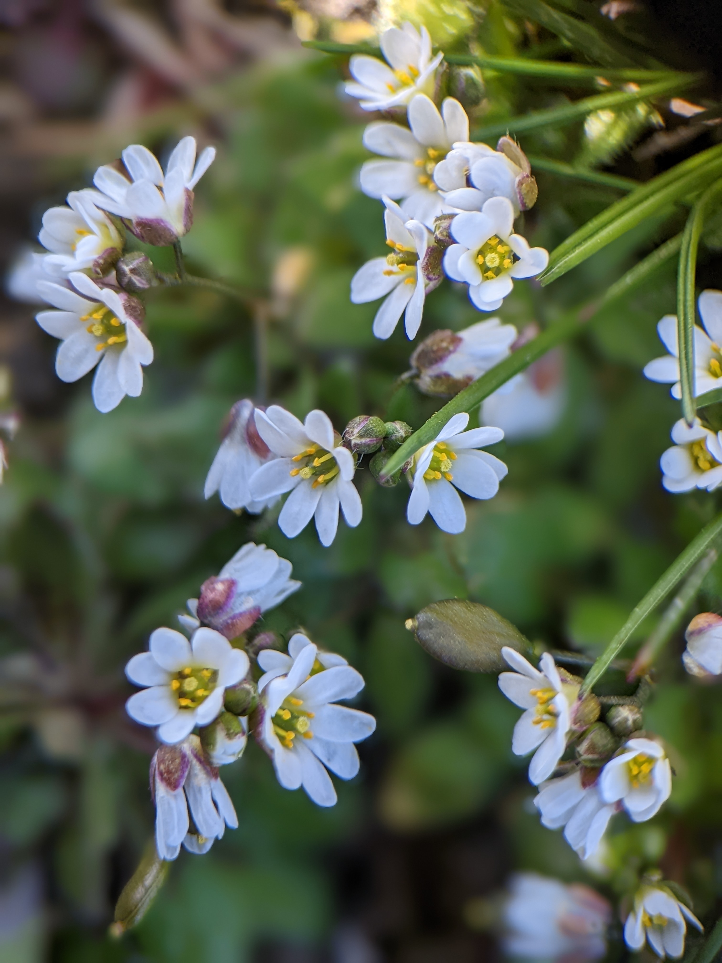
Just before we left Cornwall the week before last, and after we’d loaded the car and returned the key, I had a quiet couple of minutes leaning on the gate looking out to sea while the birds were singing their hearts out in anticipation of spring. A Mistle Thrush rehearsed his repetitive chorus; Robins sang their plaintive songs, Great Tits, Blue Tits and gulls of several persuasions added their descant; crows and Magpies rattled on about nothing much – all adding to the rhythm of waves beating on the pebble beach below; and I realized how little I wanted to leave. I struggle to quantify or even understand the healing power of nature, but I completely and gratefully accept it.

However, there were things to do back in Bath, not least a Bath Natural History Society lecture on regenerative farming given by local farmer, Jeremy Padfield. It was an excellent talk on a subject I’ve often explored in the Potwell Inn and I made so many notes that I felt inspired to write an account for the Bath Nats website and the annual report. A quick enquiry about length solicited a noncommittal response and so I set to and wrote just over 1000 words just as an email from the editor of the annual report arrived to suggest 350 words. So a postcard then! Much anguished editing and sacrifice of my little darlings boiled the stock down to a thick jus and off it went.

Simultaneously a report in the Falmouth Packet, (local Cornish newspaper which I like to keep an eye on), printed a story about the lovely strip of coastal land running up from St Just to St Ives. It’s a place we know well and have often walked, and the newspaper was working itself up into a froth because the area has just been designated a SSSI (Site of Special Scientific Interest) due to the rich biodiversity of the land which has a tremendously wide variety of habitats rare flora and fauna and even a breeding colony of Dartford Warblers. Sadly and predictably one or two farmers were describing the move as a “land grab” – comparable to Putin’s invasion of Ukraine – well Natural England weren’t exactly bombing the area in order to protect it, and at first sight this seemed like a bit of a Luddite knee jerk reaction. Nonetheless I was interested to see whether their fear of being driven off their land was justified.

The outcome was that I was reading the (54 page) Natural England report on the West Penwith SSSI at the same time as I was reading about the new ELMS scheme for Farming subsidies; trying to discover what actual subsidies would be available to Cornish farmers in the SSSI, whilst writing my piece on Regenerative Agriculture.

The lecture itself was illuminating . Since 2009 when two Duchy farms reached an agreement to work together it seems that tremendous progress has been made: here’s my shortened report.

Regenerative Farming has become a bit of a buzzword recently but it’s an idea whose time has come, not least because of the new Government policy – the ELMS scheme – which aims to move farm subsidies completely from the old system based on farm acreage to “public funding for public goods” – rewarding farmers for carrying out important environmental work. Compensation for lost output will now be based on income foregone. LEAF has two functions, firstly as a charity promoting Integrated Farm Management and secondly as a marque for food produced under LEAF standards. 

Jeremy Padfield and his business partner Rob Addicott, farm about 1000 acres of the land under Higher Level Stewardship Agreements of which 80 acres are specifically conservation managed for wildlife.  Their combined Duchy farms became LEAF demonstration farms in 2006. Over subsequent years soil organic matter averages out at around 5%; no insecticides have been used within the last 5 years; weed killing is targeted only reactively; antibiotic use has been reduced by 58% and  plastic use is down by 60%. Minimum tillage leads to a 68% drop in fuel consumption; water is intensively managed and stored, and solar energy meets much of the needs of the farm buildings. As well as wider wildlife field margins, Stratton Farms have been experimenting with skylark plots and wide strips of wildflowers and companion plants through the crops. Additionally, 20 acres of trees and 2000 metres of hedgerow have been planted. 

This may sound like a revival of traditional farming, but what makes it profitable is the use of very hi-tech equipment like drones with three yearly intensive soil testing and highly technical GPS delivery systems which have dramatically reduced the amount of artificial fertilizer applied to the soil. 

The most memorable illustration of the evening was when he took an apple to represent the earth and then cut successive slices away to represent otherwise unprofitable land. The proportion left on which food crops could be grown turned out to be breathtakingly tiny. A well attended talk which drew together the threads of shared interest that unite farmers, environmentalists and consumers. 

Dave Pole – report to Bath Natural History Society.

Impressive stuff, we thought – as seemingly most of the members present agreed. However when I checked on the DEFRA website, some of the subsidies looked pretty minimal – the best example being the skylark nesting patches for which they would receive just £10. Lapwings come in quite a bit higher. Just how much admin time it would take to replicate the old EU subsidies, or whether it’s even possible is a moot point. If these measures are not properly funded then the government will be expecting farmers to fund environmental improvement of the land from their own pockets. That would be a good deal easier for a farmer on 2000 hectares of prime land than for a small mixed farmer with just a couple of hectares of grassland in the middle of a SSSI.

Then, shockingly, the Observer this weekend featured a piece on the present state of the replacement farm subsidies being managed by DEFRA. It’s almost unbelievable, but only .44% – less than half a percent of the sum set aside has actually been paid! There was no detail on which farms and farmers had actually received their payments, but one regenerative farmer reported a 48% fall in government payments.

I’m beginning to wonder whether the undeclared policy of the government is to do precisely what those West Penwith Farmers fear most – drive them off their land in order to achieve heaven knows what objectives. After a recent edition of Countryfile on the BBC featuring the mining of lithium and selecting Cornwall as a prime area for reviving the (all kneel please) economy , I wrote to the BBC complaining that there had been no spokesperson opposing the extension of this wasteful and polluting process. If joining the dots is the only way to figure out what this government actually wants to do with the countryside I’d say that on present evidence their policy amounts to greenwashing the continuation of an extractive economy which has brought the environment to the brink of destruction.

Buddle pits, settling ponds and slag will give you a Velvet Bottom and very beautiful it will be!

This is a dam wall for a settling pond

Need I say a word about my emotional attachment to Velvet Bottom? This post, by the way, refers to lead mining rather than some kind of cosmetic procedure sold by Gwyneth Paltrow. You would be very disappointed in what follows if you were in search of that kind of amusement. The good people of Shipham may not be as enthusiastic about these old mine workings as me because some years ago they were ordered to stop growing and eating their own garden vegetables on account of the dangerous levels of cadmium in the soil -some of it, without doubt, washed down from here. The ponds are the industrial remains of a previous technical solution to a pollution problem caused when inefficient settling of the crushed ore in the buddle pits resulted in lead finding its way into the waters of the several underground rivers that spring from the limestone rock further down the Mendip escarpment; killing the fish quickly and (probably) the residents slowly. The mines have been worked and reworked since Roman times so there’s been ample time for havoc to accumulate, and this should be a salutary reminder to those who think there’s always a technical solution to every environmental problem. The effluent still contained lead, cadmium and goodness knows what other heavy metals. Just to be clear, most of this came from Victorian workings. In earlier times, back to the Romans, there was almost certainly still pollution, because mining and smelting are intrinsically polluting activities. It’s just that when they’re scaled up as they were during the industrial revolution, that they become truly dangerous. With coal from the nearby North Somerset coalfield, and probably in earlier days abundant wood, mining and smelting came together like the Kray twins of industrial growth.

But now there is peace and silence. Where lead ore was once settled in ponds, now adders warm their blood in the sun. Underground a very large system of caves was first exposed in modern times by the 1968 floods; but pioneering cavers like Willie Stanton soon found that in some places the miners had preceded them, leaving their footprints in the mud. Here and there as you walk down the valley you’ll see trial pits and occasionally swallets, gated to keep out reckless and ill equipped explorers.

However, parts of the soil here are so polluted that the whole flora has had to adapt. While we create clean air zones and fight environmental battles that may yet save us from our own historic folly, there was no-one here for the flowers and plants and when you look closely you can soon see the glittering lead slag from which some of the tracks have been made. There are places where almost nothing grows now, or ever will grow in the future. It’s so rare a habitat that it’s even got its own name – Calaminarian grassland – and there are only 450 hectares of it in the whole of the UK. The name comes from a continental violet – Viola calaminaria – that doesn’t even grow here but has the gift of thriving on soil, highly polluted with heavy metals in the parts of Europe from which the UK has detached itself; i.e. the rest of it! The calaminaria part of the name comes from the zinc containing ore, calamine with/from which calamine lotion is somehow made which is very good for calming itchy chicken pox.

So am I telling too bleak a tale about one of my favourite landscapes in the world? I really hope not, because there is an extraordinary beauty in the way that ecosystems can heal themselves. It takes time, sometimes it takes centuries; but slowly nature reclaims what we have damaged because that’s what nature does best, and bare soil is sick, unbalanced soil.

I’ve been walking up and down Velvet Bottom for something like sixty years and every time, it seems to embrace me in its remote quietness. Occasionally the trail runners and dogs owners can be a bit much. The leftovers from picnics and barbecues can be an eyesore but as landscapes go, the high Mendips – never that high – remains off the beaten track if you avoid the hotspots. But close attention to the flora there makes every walk a treat. Here’s a single example. The edges of the buddle pits and settling ponds are particularly heavily polluted but there are a handful of species that have carved out a living there. Last week we got lucky because the flower in the photos below is a very short lived annual, the flowers only open in full sun and by the time its more glamorous and eye catching cousins come along there’s nothing to see. Unless the flowers are open it’s all but invisible, but miraculously it makes a living on the bare slag, helped along I imagine by plentiful rabbit poo. It’s called Common Whitlowgrass – Erophila verna, and is found locally in these bare patches of gravel, pavements and neglected ground across the UK, mainly in the South. The flowers are barely 2-3mm across if they’re open so these photos show them greatly enlarged. You’ve probably got it growing unnoticed on your allotment or in your garden; but here in this hostile environment it’s a token of the healing power of nature.

The name Whitlowgrass comes from the fact that it was apparently used in the past as a treatment – most likely a poultice – for the infected fingernail bed that bears the same name. But not these specimens – please! They’ve got a much more important healing function; they take up heavy metals into the leaves and are potentially poisonous, and in any case it’s illegal – however common they may be. After I’d posted this I did a bit of searching and came up with this quotation from Culpeper’s Complete Herbal . Modern herbals probably don’t mention it because whitlows are a viral infection caused by the herpes virus. As an astringent it may have helped to clean any resulting bacterial infection. Any port in a storm!

“Culpeper’s Complete Herbal gives this plant an alternative name of Nailwort and tells us that ‘it is held to be exceedingly good for those imposthumes* in the joints and under the nails, which they call Whitlows, Felons, Andicorns and Nail-wheals’. The plant was carried to North America by the first British settlers where it was found to be a most useful plant in herbal medicine. “

‘Wildflowers of Ireland’ website

* Archaic term for abscesses.”

Hardening of the oughteries

Taken yesterday in Gorran Haven – who or what is “boy jowan” and is there a future for them?

The title of this post is a borrowing from Frank Lake, the inventor of Clinical Theology which has pretty much disappeared these days, but back in the day was a force for good in its attempt to make a marriage between theology and healing. Nowadays it looks like a forced marriage that was bound to fail; but this term – hardening of the oughteries – perfectly sums up for me, the danger of committing the ultimate ethical error of confusing ought with is.

On Thursday when I last posted, we were preparing for unseasonably strong winds down here in Cornwall in the far South West. An hour or so after I pressed the send button, an HM Coastguard vehicle turned up on the campsite , warning that the weather forecast had underestimated the strength of the storm that was about to make landfall, and the predicted 60 mph gusts were more likely to be up to 80 mph.

The campsite owner toured the site warning us that force ten – storm force winds – were about to arrive and giving us the option to leave ASAP if we were worried. A small convoy left the site within a couple of hours and we battened down – veterans of fifty years of western coastal camping during which we’ve lost three tents. This time we were in a campervan, it’s true, but the rest of the family were all in tents. At the height of the storm people were clinging to their tents to try to save them. Around twenty five people slept in a community room on the site while their tents were smashed by ferocious gusts of wind. In the van – broadside on to the winds – we rocked on the suspension as brief periods of silence were followed by explosive gusts slamming us.By the morning, half of the campers who’d elected to sit it out had lost their tents. It was the biggest storm we’ve ever encountered; pretty scary to see what nature is capable of throwing at us as the climate emergency advances.

All of which brings me to the oughteries. For us, and for millions of others, the link between the climate emergency and our wasteful, greedy and polluting way of life is so obvious we can splutter with rage at those who don’tor won’t – get it; and playing at being the cock that crows on the dunghill is a curiously self-regarding way of trying to change things. Hardening of the oughteries is that state of mind that abuses a kind of of self regarding personal virtue in order to detach ourselves from responsibility. When we suffer the extremes of the climate emergency there’s no virtue in claiming that we weren’t responsible because we walk everywhere and recycle plastic. Waiting for the opportunity to say “I told you so” overlooks the critical point that the climate emergency overwhelmingly affects places and people we have never met; the poorest of people generally speaking; and the kind of people who have no alternative but to become migrants and refugees in order to escape famine and wars funded by the wealthiest parts of the world and often proxy wars over scarce natural resources.

As we drove down here we took a short cut off the A30 towards St Austell and to my great surprise we passed a lithium mine. The mad rush to promote electric cars to lessen atmospheric pollution seems to ignore the obvious capacity of lithium mines to create their own unique pollution hazards. In this county which has been so hard hit by de-industrialisation and the collapse of tin and copper mining; it will be hard to say that thousands of new jobs mining lithium should be turned away. The Cornish inshore fishermen are only now realising that their dreams for a Brexit powered goldrush were a cynical con trick. I don’t want to be saying “I told you so” to any of these people, and neither do I want any of them to have to sell their houses and move away as the only option for a better future, away from the insecurity and exploitative jobs on offer in hospitality and cleaning for out of county second homers.

The ostrich approach is to believe that we can carry on the way we have and hope that the technological seventh cavalry will come galloping over the hill to save us with giant machines capable of removing gigatonnes of carbon dioxide from our polluted air. Of course it’s blindingly obvious that there are no free lunches to be had in combating climate change and big machines demand big energy to run them; setting us on a mind numbing treadmill that demands more and more energy in order to extract the pollution caused by extracting and using more and more energy.

Hardening of the oughteries simply polarizes the debate and delays any prospect of change – always to the advantage of of the biggest winners; the international corporations who stand to lose most when we finally come to our senses. Less really is more; it’s hardly a new idea but so far as I can see it’s the only viable alternative to our present course. The visionaries need to do more than shout at the cynics and so-called realists. We need to model an alternative future with every means at our disposal. It’s nothing less than a paradigm shift that we’ll need, as we watch the dream of never ending growth and progress collapse; and nothing could be a greater dereliction of responsibility to turn away and shout “I told you so” at the victims.

Almost winter

The sound of the wind sighing through these beeches is winter on a plate!

I’m not sure I go with the relatively recent introduction of what’s called ‘meteorological winter’ which begins on December 1st for no better reason, it seems to me, than an excessive love of orderliness. Yes of course it tidies the year up into four seasons of exactly three months, but the boundaries, the markers don’t coincide with any particular events in the real world. On the other hand, the astronomical seasons are marked by genuine turning points – the two solstices and two equinoxes mark actual observable events rather than concepts. I can hardly imagine anyone getting excited at the accumulation of time required to trigger a new season; whereas I get really excited about the winter solstice because it holds out the hope of lengthening days at what always seems to be (really is, often) the darkest part of the year. The same goes for the equinox, especially at the spring one, when the promise of summer is offered. The late summer is always tinged with sadness as the hours of darkness gain the ascendency once more, but there’s a glorious processional quality about the way the astronomical year reflects our mood. These moments are marked in the natural world by migrating birds like cuckoos which arrive soon after the spring solstice, before the other summer migrants, the swallows and swifts, arrive before the equinox. It all seems to add up.

All of which is a very long way of wondering aloud whether our walk yesterday could be considered a winter walk. The idea of ‘doing’ the Mendip Way – a fifty mile wander between the Bristol Channel and Frome has grown on us and without planning it at all, we’ve been grabbing any excuse to walk bits of it whenever the weather looks reasonable. High Mendip is not a place you want to be walking in freezing winds and driving rain.

Yesterday we walked a random section between Winscombe and Crook Peak – the whole section including the return walk was around 5 miles but it felt longer because there was a climb of just under 600 feet, and the walking conditions were pretty poor with the sodden ground churned to lethally slippery mud by weekend walkers. The start of the walk was diverted because there’s a massive programme of tree felling going on in the whole area, attempting to control ash dieback disease which is rife here, and so we joined the path a mile or so late, beyond Kings Wood. The weather forecast promised better than we actually experienced, but we avoided the sharp showers that we could follow as they drove across the Somerset levels from the South West.

If you look carefully you can just see the silver band of the Bristol Channel below the sky, looking westwards.

Crook Peak is the high promontory that stands guard over the M5 and would be a familiar sight to anyone who regularly drives that way. Its smaller twin, Brent Knoll, is on the other side of the motorway and I suppose the two peaks represent the last hurrah of the Mendip Hills. But the position overlooking the levels gives the most fantastic views across to Glastonbury and beyond and in the opposite direction apparently Pen y Fan in the Black Mountains can be seen 40 miles away on a clear day; so it’s well worth the effort of going to the top. Looking back you can see the Mendip way extending back across Rowberrow Warren, Burrington Combe and towards Priddy. On Thursday we’ve cherry picked a lovely walk from Priddy down Ebbor Gorge and we’ll leave the joining of the dots for later. There’s something nice about exploring the lay of the land in a series of shorter walks and then doing the whole thing in three or four sections when the days are longer.

We are so fortunate to live just 20 miles away from this marvellous walking country. When the Mendip Way is done we’ll start the Limestone Link which runs almost past our front door down to Shipham which is almost in the shadow of the Peak. I’ve written before about the intermittent lead mining industry around Velvet Bottom, and Mendip being a carboniferous limestone area, the washings from the mines all joined the watercourses as they ran underground through the rock and emerged in springs and resurgences lower down. Although the lead mines were last worked over a century ago, the villagers of Shipham were warned, quite recently, not to eat vegetables from their own gardens because they were so heavily contaminated with cadmium. The source of the contamination is now a treasured nature reserve and I suspect that most of its visitors would never even suspect what a wretched and desolate industrial area it must have been in its heyday.

So here are some photographs from yesterday’s walk. The larger photo just shows Glastonbury Tor on top of the hill in the far distance. During the recent flooding, almost all of the low lying land surrounding it was underwater. Looking down from the top we could see that there is massive dredging work going on in the Lox Yeo river to try to improve drainage. In some areas it’s been suggested that tree planting would slow down the drainage and increase water retention, but up here on the ridge the soil is often very thin, and the drainage is straight down into the rock, or more particularly its extensive cave systems, which just shows that there’s no ‘one size fits all’ answer to the problem of flooding, perhaps with the exception of arresting climate change and lessening the extreme weather events that cause the floods.

Gruffy – 2000 years of history in a footpath.

If Rodway Common was the place that fired me up as a child, this is the landscape that captured my imagination as a teenager – and I’m sorry if my attachment to these rather gloomy, post industrial places offends, but there’s a big chunk of my imagination invested out here.

I came to Charterhouse, Priddy and Burrington Combe not to explore what was on the surface but what was underneath it. I was lucky enough to get a job at the university as what was known as a “Junior Photographic Technician” – it was the kind of work an intern might get these days but there, aged seventeen, they sent me on a course to train as a technical photographer, handed me a very beautiful Leica and a darkroom, and pretty well let me get on with it; calling on me to photocopy; photograph prospective students; and capture whatever else needed recording by the lecturers and post-grads. There was a fabulously well equipped workshop run by a group of oddball technicians whose job it was to turn research proposals into bits of aluminium and electronic apparatus; and Steve was an enthusiastic caver (potholer if you’re from the north, or speleologist in America, I think), who soon took us out with him and his friends .

One of the blocked swallets in Longwood Valley

So this part of the world was the place we came to to learn about caving, using what would now be thought of as completely archaic equipment. The only way of getting a wetsuit was to make your own – which I eventually did, but my gluing of the joints was a bit wayward and it was massively tight in some places and flapped about in others making it both restrictive and inefficient at the same time. The experienced cavers often used electric miners lamps with lead acid rechargeable batteries, but we mostly kicked off with carbide lamps which were smelly, unreliable and occasionally explosive, boiler suits and black helmets that often got soft in wet caves. Ignoring the flora altogether we would crawl and slither down passages that could be very wet or very muddy; soak up the (tall?) stories of exploration and daring by the older cavers and push ourselves to the absolute limit. Perfect fun for teenage boys in fact. If there was a hole in the ground, we wanted to go down it and looking back, we took some hideous risks. My greatest friend Eddy and me had spent holidays playing in the abandoned flues and tunnels in the brickworks so extending our range to natural holes in the ground wasn’t such a great step.

So by the time Madame and me got together I knew this part of the world underground much better than above. It was here that I first heard the term gruffy ground – a miners word for the way in which the landscape is pitted with trial pits and worked out rakes. What I hadn’t thought through at the time, is that these beloved and isolated places were the relics of nearly 2000 years of the industrial extraction of lead. You can see where I’m going here – this landscape had my name written all over it.

Yesterday we waited for the rain to subside and decided to drive up to Charterhouse – less than twenty miles away in the heart of the Mendip Hills. These days it’s a popular place for walkers and there were maybe twenty cars parked above Velvet Bottom, and so we parked next to the Field Studies Centre and walked down to the entrance to the nature reserve. If you were new to this place, you might wonder where the footpath surface came from. It’s shining black and glassy, like obsidian, and it’s slag from lead smelting which began with the invasion of the Romans in the first century, but most of which was produced during the industrial revolution when this must have been a stinking and polluted industrial wasteland. So the first thing about this landscape is that – quiet and beautiful as it might be today – the pollution levels are still so high that it has its own unique flora of heavy metal tolerant plants. Lead, nickel and cadmium levels are so high that tree growth in many areas is inhibited, and gardeners in Shipham just down the road, have been warned not to grow vegetables in their gardens.

Yesterday, though, under a cloudy but clearing sky, the overwhelming first impression was of a very Mendip silence. With Bristol Airport almost out of action (marvellous) the only sounds were wild sounds; of the wind, grasses and trees and of the birds. Up on the ridge in the photograph, a noisy bunch of rooks were enjoying themselves in the air. The second impression was the smell of the sea, of the Bristol Channel, sweeping in from the southwest bearing the scent of salt water and seaweed – the closest we’ll get to the sea this year, I fear.

The plan had been for me to do some grasses while Madame looked for butterflies (she had more luck than me). If you ever ran away with the thought that I knew something about plants, now’s the time to warn you that I really don’t. Within a dozen steps I realized that my carefully researched exploration of meadow grasses didn’t fit. This is the craziest flora. Later, after we got home with me licking my wounds, I discovered that the mixed up flora is the glory of this place. Due to the nature of the underlying soils, there are acid loving plants growing very near to calcifiles and marshy ground specialists. There were old friends but more total strangers, and plants that I knew from elsewhere suddenly popping up as if they belonged there. .More from the British Geological Survey here. It’s the botanical equivalent of the favela – absolutely gripping.

So we wandered slowly down Velvet Bottom (who could resist a place with a name like that?), and found the gated entrances to a cave system discovered long after I gave up, and which turned out to be the fourth deepest cave in the country. It was here we came with the boys once, and watched a couple of adders basking in the sunny heat at the bottom of one of the depressions. The valley deepens and becomes rockier as you descend, and then just before you reach Black Rock nature reserve and then Cheddar Gorge, there’s a footpath that takes you back up the Longwood Valley – another environment altogether, but still bearing the remains of industry beneath the vegetation because water was taken from here to feed the washes in Velvet Bottom. Nowadays it’s yet another nature reserve containing more locked potholes; one of them in particular prone to sudden flooding. Longwood Swallet has a reputation for taking lives.

IMG_20200801_125812

Until this point there wasn’t much butterfly action; some whites and meadow browns; a skipper which I took a rather bad phone camera photo of; a small blue – too far away to identify properly. Then. suddenly a silver washed fritillary flying high and gliding down to feed on a bramble, then – joined by a second – doing a bit of an aerial display, seemingly unconcerned by our presence and this time I did manage to get a slightly better photo. Acid specialists, calcifiles, marsh specialists and now a broadleaf woodland dweller. If ever there was a ‘phone a friend’ place this is it! We did a field trip with a couple of county recorders leading, near here a couple of years ago and it was pretty inspiring. I must try and persuade them to lead another one on our yesterday walk.

We walked less than five miles altogether and yet what a combination of environments – I could hardly sleep for excitement last night. Mercifully it’s raining again so the allotment won’t need watering today. I need to go back to the textbooks. Oh, and isn’t it good to see that even this landscape could recover from human exploitation.

%d bloggers like this: