


There are two questions here that I’m trying to answer. The first is the title of this post, and the second is an attempt at explaining why I call myself Severnsider – and I’ll tackle that one first.
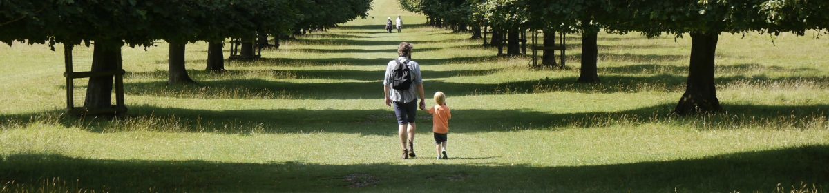
I think these photos were taken some time around 2007, although I’d known the place for years prior to that. If you live nearby, or know the river Severn on the Gloucestershire side you’ll probably know where they were taken on the Gloucestershire riverside and along the Sharpness canal at Frampton on Severn. The Severn is, as you can see, a very wide river but dangerous for larger ships to navigate above Sharpness due to the ferocious tides, winds and sandbanks. There was also a problem in sailing around a sharp bend in Arlingham which is a good place to watch the Severn bore but a very bad place for a sailing ship. The canal, opened in 1827, could carry ships up to 600 tons and was once the largest and deepest (18 feet) canal in the world . It was a safe, non-tidal shortcut to Gloucester docks. Over the decades we’ve fished in the canal, walked its towpath and paddled up it in our kayak. There are many places I love and visit but in a strange way, the river Severn has my soul. One of my parishes bordered the bank and it’s always been a place of solace on difficult days – lonely, quite remote in places with huge skies and a tide so fierce you can hear it above the mournful cries of wintering curlew.
As the tide from the Bristol channel meets the river there’s the meeting of two distinct modes of being – each with its own smell; earthy, mountainous river and salt tide. Twice a day, the inbreathing and outbreathing flows change places and command the landscape. Springs and neaps cover and reveal the mudflats
The Severn has wonderful sunsets, and on special evenings you can hear migrating geese and swans flying noisily towards the tidal marshes at Slimbridge. It’s a sound so haunting that it will freeze your blood. On one occasion I was walking on the bank at Shepperdine when a hare raced up the field to my right, leaped over a broken wooden fence and crossed, feet in front of me in mid-air. I don’t know which of us was more surprised. It was there, at high tide in the middle of the river and just inside our parish, that I scattered the ashes of a Severn pilot, a man with a lifetime of experience of the twists and turns and shifting sandbanks of the river who would take charge of ships travelling upstream . One of the crew opened a steel door in the side of the Balmoral and to the accompaniment of long blasts on the steam whistle, we poured his ashes into the water just as the tide turned and the river stood still. The trippers on the deck above us had no idea what was happening below them. The two waterways, canal and river, run side by side; the contained and dredged canal -an industrial relic of a past age and its wild and untamable neighbour. A watery Cain and Abel in perpetual conflict like the two sides of a human soul.
Inevitably, as a parish priest, I became a kind of story keeper; privy to many secrets and at ease with the history of the landscape and the people who lived in it because – in a very important sense – they were one. I may well have seen the last ever trailer load of salmon putchers being taken down to the river. The village baker’s wife and her husband had roots in both sides of the river, and would often talk about elver fishing and elver omelette where the freshly caught baby eels were tipped alive into the egg mixture in the pan. He remembered delivering bread by horse and cart. The orchards along the river were protected from frosts by the thermal mass of the water and thousands of gallons of cider were once made on local farms to slake the thirst of the labourers. I got to know one or two of the surviving cider makers pretty well. I once asked one of them why he liked cider so much and he answered “because it gets I pissed!”. The local funeral director was another hefted man who began life as a builder and joiner and made coffins according to the custom of the day; graduating to funeral directing as a natural progression. The gravedigger would always discreetly press a jelly baby or some other sweet into my hand as we processed to the graveside. It was a surviving custom from when everyone was rewarded in cash after a funeral. We referred to one another as gentlemen and bowed as if we were born to it.
I was the story keeper because I took many of the village funerals, weddings and baptisms. I have never felt able to write about those years in any detail because so much of what I knew was told to me in confidence, but I learned the skill of discreet storytelling over three decades, slipping in a coded morsel known only to the closest friends when I could. Most of the old ways and those who followed them are gone now and the suburban villages empty of commuters and refill again in the evenings. The salmon have all-but disappeared and the churches are shrinking and falling into disuse.
Oh yes; the Severn is a very special place and having lived next to it for 25 years it’s the reason I use the name Severnsider. Although these days we live in Bath, the campervan is stored near the banks of the Severn, and the river Avon on whose bank we now live, is a tributary to the mother river which it joins at Avonmouth.
Anyway enough history, because I want to move on to the more interesting question of storytelling with pictures, and the impact of computer technology enabling us to do things we could not have contemplated thirty years ago when I stood on the riverbank, looking at the long row of apparently abandoned barges, hauled up and left to rot. I know, of course that there was a story shouting to come out of the landscape. The melancholic look of rusting hulks and concrete tow barges sinking inexorably into the estuary mud suggested a catastrophic collapse in the market of some commodity. That was a wrong assumption as it turned out because they were deliberately scuttled there in an attempt to protect the river bank from erosion. The pictures haunted me.

I knew I had the raw materials of a new way of understanding landscape but there seemed to be no way of making it work. I wanted to find a way of telling stories with pictures and text but which you could enter at any point, and so read in any order – which is much closer to the way we actually apprehend landscape in real life. Then I discovered HTML but not being very computer literate, the learning curve defeated me. It was the arrival of journaling software and later blogging software that finally opened the door for me. I could utilise the thousands of photographs I’d taken over the years and write accompanying text that could illuminate any topic I was writing about. The photos weren’t eye catching snapshots but little visual haiku, working with the text to say what couldn’t easily be said in words. They became little essays, often exploring a single idea with no attempt for them to be amalgamated into a theory of everything. By now there are over a thousand of them, rapidly approaching a million words in a form that can be searched by date, by topic, by keyword or even just with a single search term.

All this because a single photograph can conjure up a whole habitat or environment; a whole history of the people who live and work in it and occasionally amount to a funeral sermon for something or someone lost forever. This photograph, for instance, taken on Thursday at Big Pit above Blaenavon suggests to me something that’s not telling the whole story; that needs unpacking. The bright red paint and hand lettering suggest that this truck does not, any longer, contain explosives at all. It’s there for effect, as part of an experience – which is what it is, of course. Possibly a film set.

But this one, taken moments later, is telling a more subtle story; of abandonment and dereliction. Present and past are expressed in the course of a few words on a screen. Now we know that something infinitely less fun is going on. There are two steam engines there, each of them deserving restoration but lacking the funds to do it. In a supreme irony, the high quality steam coal which was mined here and which is needed by every steam restoration project in the UK can no longer be mined because of the environmental damage caused by burning coal. We were told that the last two shipments of steam coal came by boat from Chile and Australia. So coal will still be burned but also thousands of tons of oil burned added to the total environmental cost. A third photograph has an entirely more melancholy feel because behind the abandoned winch gear, and in the distance, lies a town that feels as abandoned as the headworks of the pit. With the end of coal mining, thousands of jobs were lost and never replaced with skilled work. Coal was King and now unemployment drains the eviscerated community below. The museum is a marvellous and pointed reminder of yet another lost community.

Oh how miserable this is sounding! Let’s turn to nature. Many of the thousands of photographs I’ve taken are of plants, fungi and even insects. They’re the other part of landscape – the micro features that make it what it is. You’ll know if you’ve read this blog for any length of time, that I’m pretty passionate about the waifs and strays of the plant world which find a place to settle in precisely the abandoned post industrial sites, marginal environments and polluted earth that – like the human communities that once lived and worked in them – have fallen silent as the dreams of the industrial revolution; of easy lives and plentiful housing and food for all come to dust. Things are unravelling and we all know it, in spite of the performative idiocy of politicians who think that having your photo taken with a hi-viz jacket, hard hat and sleeves rolled up is a substitute for having any idea or plan for the future.
Is it even possible to love a despoiled landscape and yet hate what caused it? I think I’m able to address that paradox in a way that might offer a way forward. Firstly the earth doesn’t need us nearly as much as we need the earth, and so in recording what’s there needn’t be a source of anger is much as an encouragement and inspiration to do better. To do better for human communities, to do better for the plants and insects and animals share the earth with us. On our walk in the Bannau Brycheiniog on Thursday we were looking at some slime moulds – a subject which I know almost nothing about. But I did a quick search in Merlin Sheldrake’s book “Entangled Life” and discovered that the humble slime mould can help to make a map to escape from an Ikea store with no more encouragement than a few bright lights and some oatmeal. We dismiss the strange intelligence of nature at our peril. We shall need to review, and experiment and rethink the way we do things around here – I mean our whole culture – in a way that no-one in living memory has had to do because the crisis is here. Even our short journey across the Severn was delayed by 24 hours by an unprecedented storm. Our memories of the past need not fall into the trap of sentimentality and nostalgia. We can be grown-up enough to see that the communities built up by mining had costs as well as benefits and we need not return to the whole package of riches extracted and suffering exacted. What nature demonstrates is the persistence that comes from environmental stability, and so to finish here’s a photograph taken on our friends’ smallholding of a small patch of ancient woodland which has been protected by the steepness of the field in which it stands.


 That’s just to set the scene a bit – yesterday we set off from Hollybush in deteriorating weather and by the time we got to the top of the first climb it was sheeting down, blowing a hoolie and extremely cold. We carried on and the weather slowly improved and by the time we got to Sally’s Place (great refreshment hut) at British Camp, the sun had put in an appearance. But looking out towards the Severn from the vantage point of the hilltop we could see how much flooding there is at the moment. It’s not possible to discern the actual course of the river unless it’s by the tops of the bankside trees. For the most part the flooding extends for several fields either side, and of course larger towns like Upton on Severn, Tewkesbury and Worcester (OK I know it’s a city but writing the list any other way looks pedantic!) – are severely affected once again. After a four hour walk out and back we arrived at Hollybush again just as the rain got organised and we drove home in opposite directions, both of us – it turned out – in appalling driving conditions.